
TIMELINE OF CLIMBS and SOME LONG BACKPACKING LOOPS
[ Trips and Albums by year, newest first ]
2021
-
Trip Name: Spring 2021 Overview: I'd had such bad luck in May/June 2015 that I just didn't want to get caught in late spring stroms again. By 2021 I was ready to take that chance and see if I could enjoy some fine alpine adventures before the snow disappeared. It had been a low snow winter (50% of normal) so access was bound to be good. Most of the trailheads were already open when I arrived on the 5th of May. Timeframe: May - June Description: The intent was to get really fit here in the Sierra before heading east to WY for July/August. No real game plan other than to see some locations I hadn't yet visited and tag a few more summits on my flexible tick list. Camera:
The Albums:
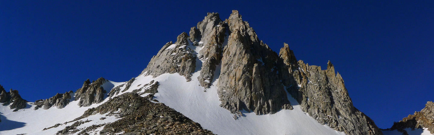
| Album Name: | Mono Pass - Starr Mt |
| Region: | Mono Recesses |
| Destination: | Starr Mt - South Ridge |
| There with: | Solo |
| Date: | May 7, 2021 |
| Nights Out: | 0 |
| Description: | Always a good idea to get some easy altitude under your belt with a warmup upon arrival from lowly NH. A hike to Mono Pass is familiar ground, but I'd never been to the top of Starr Mt. Worth the effort particularly if you go by way of the South Ridge. The views from the top are excellent. The quick descent is down the chossy gravel fest on the west side, but I should have reversed the route and kept the quality factor at a higher level. |
| # of Images in album | 15 |
| Image Size Upd (Y/N): | Yes |
| Album Name: | Sawmill Pass - Mt Acrodectes |
| Region: | The High Passes |
| Destination: | East Ridge of Mt Acrodectes |
| There with: | Solo |
| Date: | May 11-14, 2021 |
| Nights Out: | 3 |
| Description: | The first springtime adventure in the High Sierra since 2015. Long overdue. After a warmup hike/climb of Mt Starr above Mono Pass, it was time to spend some time in a region I had only briefly visited in 2014. A day trip to Sawmill Pass is probably done all the time. But from there I knew little or nothing about the Woods Lake Basin. A Peaks for Freaks trip report showed an awesome view of the North side of Mt Acrodectes. The TR reported that the East Ridge scramble was quite nice. So, with 3 nights of food I headed back up to Sawmill Pass - starting at 4:45am to beat the heat. Couldn't find a campsite below the pass so ended up going all the way over and down to a nice little tarn at about 11,000'.. From there I had a beautiful view of the area and the the peak itself. |
| # of Images in album | 44 |
| Image Size Upd (Y/N): | Yes |
| Album Name: | Mt Mills |
| Region: | Mono Recesses |
| Destination: | Mt Mills - up one side and down another |
| There with: | Solo |
| Date: | May 19, 2021 |
| Nights Out: | 0 |
| Description: | Have always wanted to climb Mills particularly after seeing it from the summit ridge of Abbot in 2012. Like others I would prefer to do the North Couloir but the approach is long. In this case I got my wish but having climbed the left hand East Face gully, I was not at all interested in descending the same way. That left few choices. Since I'd always wanted to see the Fourth Recess and it was only 9am when I summited, I decided to down climb the North Couloir and wrap around back to Mono Pass the long and scenic way. That it was. Left the truck at 3:30am and got back at 7:30pm. Sixteen miles / 16 hours. What a day. |
| # of Images in album | 39 |
| Image Size Upd (Y/N): | Yes |
| Album Name: | Mt Agassiz |
| Region: | The Palisades |
| Destination: | Mt Agassiz - Northwest Face |
| There with: | Solo |
| Date: | May 26, 2021 |
| Nights Out: | 0 |
| Description: | Another long day climb though in this case it was the reverse of last week. Longer climb shorter hike. Still round trip to Bishop Pass and 2000' of climbing added up to a 12 hour day. Only flaw in an otherwise great day was the choice of descent. Once again I didn't want to downclimb the long snowy ascent. Instead I opted for trying to find a rocky ridge. But, from the top, the view of your choices is not clear. Long story short, I choose poorly. Way too far to the west in the choosy gullies. Ugh. Still, another great spring day in the High Sierra |
| # of Images in album | 27 |
| Image Size Upd (Y/N): | Yes |
| Album Name: | Mt Lyell |
| Region: | The Minarets and June Lake |
| Destination: | Mt Lyell - Northwest Ridge |
| There with: | Solo |
| Date: | June 8-12, 2021 |
| Nights Out: | 4 |
| Description: | The last big effort of the 2021 season. Seems like May is already a distant memory now that the crowds, heat and bugs have arrived in the high country. On my long but scenic approach via Rush Creek / Spookey Canyon I lost count of the huge numbers of PCT thru hikers - some doing sections, others going for the full enchilada. One thing I did not see this entire season is another climber. Kind of odd. Anyway, the std route on Lyell is a real classic. As usual it seems at odds with the Secor description of the route rated at class 2-3. While the summit ridge is indeed class two, the fine solid rock found the face just left of the upper col is not class 3. If it is, it's 3+ no fall climbing. Steep, solid and blessed with holds in all the right places. Most likely there are other ways to go, but the intuitive way was even marked by several small cairns. Downclimbing the route is definitely the crux. The view from the top is not to be missed. |
| # of Images in album | 72 |
| Image Size Upd (Y/N): | Yes |
2019
-
Trip Name: Fall 2019 Overview: A month in the High Sierra. Mostly on the east side but I did drive around to the west side so I could do one long loop hike out of Courtright Reservoir. A really different weather pattern this year. Colder than normal with more than a few days of stiff to stout winds.Dry the entire time. Timeframe: Sept - October Description: After a couple of weeks in WY/CO I got to the east side on the 4th of Sept. One day hike and three backpacking trips later it was the 9th of October and I was headed home. A pretty good year. Only wish I had done more real climbing as I had in the Rockies. Camera: Olympus OMD E-M10
The Albums:
| Album Name: | McCabe Pass - Shepherd Crest |
| Region: | Northern Yosemite |
| Destination: | Shepherd Crest |
| There with: | Solo |
| Date: | Sept 11-13, 2019 |
| Nights Out: | 2 |
| Description: | After a warm up hike to McGee Pass (LOL - 20 miles), Chuck and I went searching for a shorter adventure where we could bag some sort of peak. We settled on the Steelhead Lake region where we could stay at the lakes just up the trail and explore McCabe Pass etc. In doing so we saw that an ascent of Shepherd Crest would be a logical extension of something to do once you reach the pass. A smart choice. The view from the top is one of the best I've seen in this part of the High Sierra. |
| # of Images in album | 36 |
| Image Size Upd (Y/N): | Yes |
| Album Name: | LeConte Divide |
| Region: | Kettle Ridge and the Leconte Divide |
| Destination: | Six Pack of Passes - the LeConte Divide |
| There with: | Solo |
| Date: | Sept 19-25, 2019 |
| Nights Out: | 6 |
| Description: | This trip is something I've wanted to do for a long time. I'm glad I waited until this year. I had an incomplete vision of what was possible and what would work for me. Two trip reports helped. One from Peaks for Freaks and the other, a Flickr album by Craig Taylor opened my eyes to how much more there was than just getting to Hell for Sure Lake and Pass. Indeed. |
| # of Images in album | 113 |
| Image Size Upd (Y/N): | Yes |
| Album Name: | Upper Kern Basin - Forester Pass |
| Region: | Kings Kern Divide |
| Destination: | Exploring the Upper Kern River Basin |
| There with: | Solo |
| Date: | Oct 2-6, 2019 |
| Nights Out: | 4 |
| Description: | With a good forecast and diminishing winds it seemed like a loop up to Harrison Pass from Lake S. America to have a go at Gregory's Monument - Stanford was just the ticket. What the forecast didn't get right was the winds. A 2 day blow came along just as I arrived in the barren open upper basin. The temps were cold made even more so by the strong gusty winds. I bailed for the JMT and a trip to Forester Pass. Then the weather self corrected and it got warm and calm. Go figure. All in all a rather disappointing way to end the season. I really missed doing a real climb. Once I was out, the skies remained clear but the winds returned. Was hoping to enjoy some cowboy camping up on the Gorge Road. Got one calm day. By the night of the 9th, my last night in California, the winds were roaring and Bishop was enveloped in one big dust storm. |
| # of Images in album | 64 |
| Image Size Upd (Y/N): | Yes |
2018
-
Trip Name: Fall 2018 Overview: A bit of a longer visit than last year. I left home on the 2nd of Sept and got back on the 19th of October. Timeframe: September Description: Did some hikes in Wyoming on the way out. Visited the Medicine Bow Range and hiked out to Mistymoon Pass in the Bighorns. That's a place I want to return to next year. This year I was determined to get back into climbing so I focused almost entirely on doing so. The first three trips included Emerson, Matterhorn and Starlight. Each climb was unique in it's own special way. After the Palisades a batch of rain/snow came thru so my finale this year was a quick three day loop hike on the front side of the Ritter Range. Again I started in Rush Creek and went in via Summit Lake. Camera: Olympus OMD E-M10
The Albums:
| Album Name: | Emerson SE Face |
| Region: | Evolution Region |
| Destination: | Mt Emerson Southeast Face |
| There with: | Solo |
| Date: | Sept 13, 2018 |
| Nights Out: | 0 |
| Description: | Given it's short approach and reputation as a fun climb, Emerson seemed like the perfect start to the fall campaign. I was feeling the need to actually climb while out here and really hadn't done so since 2014. I spent the day wondering if I was off route, and while I can imagine there are many ways to do this route, I did hit the all important notch up at about 12,700' where the fun begins. |
| # of Images in album | 23 |
| Image Size Upd (Y/N): | No |
| Album Name: | Sawtooths Finger Lakes |
| Region: | Northern Yosemite |
| Destination: | Matterhorn - West Ridge |
| There with: | Solo |
| Date: | Sept 17-21, 2018 |
| Nights Out: | 4 |
| Description: | In 1983 after a big snow year, Mary Erdei and I came to the area to climb the North Arete. After an epic approach during which one of our dogs almost drowned as she got carried away in the ragging horse creek and almost disappeared into a snow hole, only to be snatched from the jaws of death at the last second we soberly carried on and setup camp beneath the climb. This was another route we did back then where all slides and for that matter most memories are lost in time. This year (2018) I came back with the intention of seeing more of the area and climbing the peak by a route I could comfortable solo. The standard SW slopes has no appeal to me and only recently I read a trip report of a more suitable alternative being the West Ridge from Burro Pass. With that in mind, I put together what I hoped would be a nice scenic route there and back. Warm days and cold nights were standard fare for the four and a half days this trip took. |
| # of Images in album | 61 |
| Image Size Upd (Y/N): | Yes |
| Album Name: | Palisades West Side |
| Region: | The Palisades |
| Destination: | Starlight - Northwest Chute |
| There with: | Solo |
| Date: | Sept 25-27, 2018 |
| Nights Out: | 2 |
| Description: | It seems to me no resume of Sierra Climbing would be complete without doing a few of the 14ers along the Palisades crest. I'd done Thunderbolts West Ridge and the Swiss Arete on Sill back in 81 and 79 but have literally one slide to show for those two long ago adventures. Of all the "chute" climbs on the west side of the divide, it seemed like the Northwest Chute on Starlight had the most personality. Perhaps the West Face (5.4) of North Pal is a better option, but I could find zero beta on that route other than the sparse descriptions in various guides. So Starllight got the nod. Going over Thunderbolt Col on a really dry year makes almost no sense because you then need to drop down about 500' to find water. That experience was enough to convince me that after the climb I was going to return to Bishop Pass via the very scenic Knapsack Col. There is alot of beta on this route so I didn't have any issues with the route and near the top took the left hand option to reach the summit. I then climbed up a small pinnacle just SW of the Milk Bottle - one that is maybe 3-4 feet shorter in height and one I've never seen pics of climbers on the coveted boulder problem taken from. That was my summit. On the way down, the loose scree and gravel spoiled what was a pretty good route. I ended up doing 5 raps with a 7.7mm 50m rope. Note: album photo taken in May 2013
|
| # of Images in album | 50 |
| Image Size Upd (Y/N): | Yes |
| Album Name: | Unsettled Weather |
| Region: | Mammoth Lakes and the Silver Divide |
| Destination: | Storms and Convict Canyon Hike |
| There with: | Solo |
| Date: | Oct 3-6, 2018 |
| Nights Out: | 0 |
| Description: | After Starlight I took my normal 3 days of rest, but as that came to an end 3-4 days of stormy weather arrived. I finally got a good day on Oct 5th and decided on a trip up Convict Canyon to Mildred and Dorothy Lakes. The extra effort to get up to the Dorothy lake is worth the effort as the view really opens up. The view of the north side of Red Slate and its appealling couloir is much better too. Even after all the rain, the notorious stream crossing at the old washed out bridge was quite casual. The trail itself may soon be a thing of the past as weather events have done tons of damage to what is a problematic trail to begin with. Still a fine day and well worth the effort.
|
| # of Images in album | 28 |
| Image Size Upd (Y/N): | Yes |
| Album Name: | Intro to Ritter Range |
| Region: | The Minarets and June Lake |
| Destination: | Rush Creek Ritter Range Loop |
| There with: | Solo |
| Date: | Oct 9-11, 2018 |
| Nights Out: | 3 |
| Description: | With only a week to go before I was due to pull up stakes and head back to NH, there was time for one more adventure. After a false start thinking I wanted to go to Hell for Sure Pass over on the West Side (I did drive all the way up to Courtright Reservior), I came back and settled on plan B. That turned out to be an intro to the Ritter Range and Minarets. Knowing the shortest way in there was to use the now familiar Rush Creek approach, I came up with a Summit Lake loop. Lots of ups and downs along with some aggressive camping restrictions, but still a nice intro to the area.
|
| # of Images in album | 58 |
| Image Size Upd (Y/N): | Yes |
-
Trip Name: Spring 2018 Overview: A really short trip to the East Side. Timeframe: May Description: A massive misjudgement to say the least. After a very slow start the High Sierra snow levels caught up to normal in March/April. My research was to put it mildly - faulty. So after a week in the area I decided to reset the plan and return instead around Labor Day. I could then stay until I'd had my fill. Camera: Olympus OMD E-M10
The Albums:
| Album Name: | False Start |
| Region: | The High Passes |
| Destination: | East Side False Start |
| There with: | Solo |
| Date: | May 3-7, 2018 |
| Nights Out: | 0 |
| Description: | I was a bit unprepared for all the snow after what I thought was a lean winter. While the hike to the top of Gould was mostly snow free, the view into the backcountry convinced me that it was going to be a while before the lakes started melting out and trails in the forest reappeared. |
| # of Images in album | 42 |
| Image Size Upd (Y/N): | No |
2017
-
Trip Name: Fall 2017 Overview: The really big winter of 16/17 was like turning back the clock 1 month. Sept 2017 was full of wildflowers, thunderstorms, snowfields and green meadows. Timeframe: September Description: Betsy and I drove out in late August by way of Beartooth Pass and Stanley Idaho. We got to Bridgeport on our 5th day. We then did some hiking in Yosemite, KCSP and Mammoth Lakes before she needed to fly homr for her real job. I then did the long walk to McGee Pass, a 6 day loop around Silver Pass, a day hike to Virginia/Summit Lakes followed by a very nice 5 day trip to Kaweah Gap and back. After that I needed to get home in time for my friends wedding. Camera: Olympus OMD E-M10
The Albums:
| Album Name: | Yosemite - Mammoth |
| Region: | Mammoth Lakes and the Silver Divide |
| Destination: | Yosemite - SNP - Mammoth area hikes |
| There with: | Betsy Harrison |
| Date: | Aug 21 - Sept 1, 2017 |
| Nights Out: | 0 |
| Description: | This time around Bets drove out with me and we had a great 2 weeks of exploring and relaxing in the Yosemite, Sequoia NP and Mammoth regions. We went out to Clouds Rest, Moro Point and Duck Pass. |
| # of Images in album | 30 |
| Image Size Upd (Y/N): | No |
| Album Name: | McGee Pass |
| Region: | Mammoth Lakes and the Silver Divide |
| Destination: | McGee Pass Trail |
| There with: | Solo |
| Date: | Sept 4, 2017 |
| Nights Out: | 0 |
| Description: | After two weeks with Betsy wandering around the Sierra and introducing her to places she hadn't seen (the west side in particular), she flew home to the real job and I settled on doing this long 20 mile round trip day hike. Throw in 4000 feet of gain and you can bet my tank was empty when I got back to the trailhead. Big cloud buildup but at best at bit of a spritz from time to time. Lots of snow, bugs and wildflowers. |
| # of Images in album | 36 |
| Image Size Upd (Y/N): | Yes |
| Album Name: | Mono Pass - Silver Divide |
| Region: | Mammoth Lakes and the Silver Divide |
| Destination: | A Loop Around Silver Divide |
| There with: | Solo |
| Date: | Sept 8-13, 2017 |
| Nights Out: | 5 |
| Description: | The idea here was to use Mono Pass as a way to get to and cross the Silver Divide twice. On the way in I would use 'Shout of Relief' Pass on the SHR to cross over to the north side and after connecting to the JMT would cross back over via Silver Pass. After that I would have the option of getting back to Rock Creek in one of three ways: 'Half Moon Pass', Mono Pass or the longer but more interesting 2nd Recess to Gabbot Pass and on over the Divide at Cox Col. In the end I choose the way I'd come in mostly because I was tired and wasn't sure what kind of snow conditions to expect on Cox Col. I did not have an axe or micro spikes with me. As boring as that decision sounds it certainly was not. If fact it ended in high drama - weather wise that is. |
| # of Images in album | 100 |
| Image Size Upd (Y/N): | Yes |
| Album Name: | Virginia Lakes |
| Region: | Northern Yosemite |
| Destination: | Day Hike to Summit Lake |
| There with: | Solo |
| Date: | Sept 19, 2017 |
| Nights Out: | 0 |
| Description: | Its been quite windy lately so pick your poison. After this and that I decided a quick trip to summit lake would work (10 miles RT). A second look at the map revealed a pass that had to be crossed to get there. So, good workout. A bit rocky on the west side of the pass. But that's just me and my fused ankles. Wind was stout to start but moderated by the end of the day. Fuzzy clouds gave way to a very nice afternoon. |
| # of Images in album | 25 |
| Image Size Upd (Y/N): | Yes |
| Album Name: | West Side Sequoia |
| Region: | The Kaweahs and the GWD |
| Destination: | Crescent Meadow to Nine Lakes Basin |
| There with: | Solo |
| Date: | Sept 25-29, 2017 |
| Nights Out: | 4 |
| Description: | A seriously over ambitious plan was quickly reconciled with reality and morphed into a nice 5 day trip to Nine Lakes Basin and back. Nights 2 and 3 were fabulous examples of being in the right place at the right time. The original plan would have seen me in the forest both these nights. I'm felling pretty lucky about that. The lesson learned on this trip was that I need to lighten my load if I'm going to keep doing these trips. |
| # of Images in album | 79 |
| Image Size Upd (Y/N): | Yes |
2016
-
Trip Name: Fall 2016 Overview: The last of the dry years was about to come to a close. The backcountry was so dry that many of the small tarns and streams had gone dry. The weather however was most cooperative. Timeframe: Sept - October Description: Upon arrival I headed straight out for a 7 day loop around Mt Lyell by way of Rush Creek. After some rest time I then did a 5 day loop of Piute Creek, Goddard Canyon, Davis Lakes and Darwin Canyon. I hadn't been to Darwin canyon since 1981 it was almost like seeing it for the first time. Camera: Olympus OMD E-M10
The Albums:
| Album Name: | A Loop Around Mount Lyell |
| Region: | The Minarets and June Lake |
| Destination: | Donohue, Vogelsang, Blue Lake and Clinch Passes |
| There with: | Solo |
| Date: | Aug 31 - Sept 7, 2016 |
| Nights Out: | 6 |
| Description: | Sept 2016. Started off the Fall season with a long 65 mile loop around Mt Lyell. Didn't know much about this region but after seeing some images of Twin Island Lakes I wanted to find a way to see this and other parts of Yosemite and Ansel Adams Wilderness. In hindsight I'm not sure the best way to start this loop was at Silver Lake. The trail up to past the reserviors to the JMT provides quick access, but that's about it.
I spent the 1st night just south of Donohue Pass, the 2nd on the south shore of Evelyn Lake, the 3rd at the Lyell Fork of the Merced River, the 4th below Blue Lakes, and the 5th at the top of the North Fork of the San Joaquin River. After crossing Clinch Pass I spent the 6th and last night at Rogers Lakes before re-connecting with the Rush Creek Trail the next morning. |
| # of Images in album | 146 |
| Image Size Upd (Y/N): | Yes |
| Album Name: | Piute - Goddard - Darwin |
| Region: | Evolution Region |
| Destination: | Piute, Goddard and Darwin Canyons Loop |
| There with: | Solo |
| Date: | Sept 14-18, 2016 |
| Nights Out: | 4 |
| Description: | Sept 2016. Next up was a somewhat convoluted attempt to see more of the North Lake to South Lake terrain that I have such fond memories of (1981). Also wanted to see some new terrain so I added a trip up Goddard Canyon with a exit back to the JMT via the north fork of Goddard Creek and Davis Lake. A comfortable 4 night trip with a serious dislike of the rough conditions over the last couple of miles of the Piute Pass trail as it approaches it's end at the JMT. Darwin Bench and Canyon was as expected a wonderful place to be. The real surprise was how nice the terrain leading up to and around Davis Lake was. Alot less talus and scree than I had been prepared for. |
| # of Images in album | 114 |
| Image Size Upd (Y/N): | Yes |
| Album Name: | Called on Account of Pain |
| Region: | Kings Kern Divide |
| Destination: | An attempt to get to the GWD via Forester Pass |
| There with: | Solo |
| Date: | Sept 27-29, 2016 |
| Nights Out: | 2 |
| Description: | Plan was to go do Thunder by way of Kearsarge / Forester passes and to see Picket Creek to the west of the GWD. On the first night got violently sick with abdominal cramps all night long. Completely exhausted by morning. A bit confused as to what was happening so took 2 casual days to walk back to Onion Valley. |
| # of Images in album | 28 |
| Image Size Upd (Y/N): | No |
2015
-
Trip Name: Fall 2015 Overview: After the disappointing spring visit, I decided to come back in the fall and see what that would be like. It was the year of the Rough Fire, but other than that, the weather was warm and dry. Timeframe: Sept - October Description: Flying out West with all the gear you need for 3 week in the backcountry is challenging. 100lbs and your carry ons. Hardest part was lugging it around the Las Vegas airport getting over to the car rental. The smoke in the Owen's Valley was pretty thick so I drove around to Wolverton and did a really nice 7 day loop up to the Tablelands and out via Bearpaw. After a short break and a couple of stormy days, I did a nice 4 day trip into Reflection Lake and up to Pilot Knob. I wanted to stay longer, but I was out of time and the days or should I say the nights were getting pretty long by the middle of October. Camera: Olympus OMD E-M10
The Albums:
| Album Name: | Tablelands |
| Region: | The Kaweahs and the GWD |
| Destination: | Tablelands to Lion Lake Pass |
| There with: | Solo |
| Date: | Sept 25 - Oct 1, 2015 |
| Nights Out: | 6 |
| Description: | Sept 2015. After the stormy spring left me feeling like I hadn't accomplished much I made plans for a fall trip where I could experience the range without concern for snow. Arriving in Lone Pine after the drive over from Vegas, I found the whole Owens Valley full of haze and smoke. Next morning I drove around to the west side and made the hot drive up to Wolverton and what I hoped would be better vistas south and west of the Rough Fire. Other than a 24hr stretch of haze and grey skies, things worked out pretty well. |
| # of Images in album | 115 |
| Image Size Upd (Y/N): | Yes |
| Album Name: | On the Tourist Path |
| Region: | Owens Valley |
| Destination: | On the Tourist Path - Snow storms and Fall Foliage |
| There with: | Solo |
| Date: | Oct 2-9, 2015 |
| Nights Out: | 0 |
| Description: | Oct 2015 - While it may have precluded some high peak ascents, the snow storm the first week of Oct added some great potential to both on oncoming fall color and the generally dry look of the Sierra in the fall. |
| # of Images in album | 36 |
| Image Size Upd (Y/N): | Yes |
| Album Name: | Reflection Lake |
| Region: | Kings Kern Divide |
| Destination: | Longley Pass and Pilot Knob |
| There with: | Solo |
| Date: | Oct 10-14, 2015 |
| Nights Out: | 4 |
| Description: | Oct 2015. After the Tablelands adventure and a week of stormy weather, there was enough time left for a five day somewhere. With all the high peaks showing a winter look it seemed fitting to finally take the long walk into see Reflection Lake and upwards to Longley Pass |
| # of Images in album | 84 |
| Image Size Upd (Y/N): | Yes |
-
Trip Name: Spring 2015 Overview: Spring 2015 was different kind of year for me. After a lean winter the weather in May was mostly unstable and short storms were the norm. The weather never really stabilized. Timeframe: May Description: I got in alot of miles but my success ration was not much to write home about. The weather was OK for a hike to Baxter Pass, Bullfrog Lake and a climb of Muir. After that the weather changed and never really recovered. During this period I did trips to Baker Lake, South Fork of Tuttle Creek and Finger Lake. By the end of the month there was more snow up high than when I had arrived at the end of April. Camera: Olympus Stylus 1
The Albums:
| Album Name: | The High Passes |
| Region: | The High Passes |
| Destination: | Day Hike to Baxter Pass |
| There with: | Solo |
| Date: | April 28, 2015 |
| Nights Out: | 0 |
| Description: | Having enjoyed the hike to Sawmill I was hoping that Baxter would offer up a similar experience. Well sort of but not really. Rocky, rough and other than the alpine looking spur off of Mary Austin and Diamond Peak, a fairly long day without alot of drama. These long day hikes always mean you spend most of your day moving along in what I call the non 'magic hour' when the lighting for photography is less than optimal |
| # of Images in album | 22 |
| Image Size Upd (Y/N): | Yes |
| Album Name: | Bullfrog Lake |
| Region: | The High Passes |
| Destination: | Day Hike to Kearsarge Pass and Bullfrog Lake |
| There with: | Solo |
| Date: | May 3, 2015 |
| Nights Out: | 0 |
| Description: | A quick trip to Kearsarge Pass is one of the better ways to see how much snow is left in the backcountry. Extended it a bit walking out to the JMT. Should have gone to Glen Pass - there was plenty of time. |
| # of Images in album | 19 |
| Image Size Upd (Y/N): | Yes |
| Album Name: | Mt Muir |
| Region: | Whitney Region |
| Destination: | Mt Muir - Std West Face Route |
| There with: | Solo |
| Date: | May 5, 2015 |
| Nights Out: | 0 |
| Description: | Another snowy April left me looking for a day route that would help with conditioning and tag a summit. Most of the low hanging fruit had been plucked. A return to the Whitney region turned out to be just the ticket. Hadn't been there since 1981. The std route on Muir is a shadow of the big east face, but still a worthy route as the summit block contains some nice stout bouldering which to me seemed more 4th class than not - at least the way I went. |
| # of Images in album | 28 |
| Image Size Upd (Y/N): | Yes |
| Album Name: | Baker Lake |
| Region: | The Palisades |
| Destination: | Baker Lake - Skyhaven Pass |
| There with: | Solo |
| Date: | May 10-12, 2015 |
| Nights Out: | 2 |
| Description: | Ramping up for a wet spring, the first of several storms blew thru adding to my downtime. After a 3 day affair I got going again with a scenic trip to Baker Lake via the North Fork of Big Pine Creek. Plan was to top Skyhaven at sunrise. Could have worked, but it didn't. A mostly cloudy sunrise gave way to fierce winds at the pass and little or no reason to scramble up to the summit given the grey cold skies. Settled for a consolation prize by camping at the edge of the drop back in the Big Pine Creek. Enough snow was found to take care of water issues. The 3rd day sunrise was of course perfect. |
| # of Images in album | 36 |
| Image Size Upd (Y/N): | Yes |
| Album Name: | Tuttle Creek |
| Region: | Whitney Region |
| Destination: | Tuttle Creek - South Fork |
| There with: | Solo |
| Date: | May 22-23, 2015 |
| Nights Out: | 1 |
| Description: | After Baker Lake a larger front arrived. For eight days, more or less, it snowed, rained, melted and froze. I considered going elsewhere but in the end just waited it out. Some mornings during this period were clear. But it never lasted. When it finally looked to be over I decided my options were limited so a return to Tuttle Creek seemed in order. I thought another trip up Langley and a scramble up Tuttle Peak might be doable. What I got instead was the sucker storm of the season. It rained and snowed all night. I woke up to six inches of new snow and whiteness all the way down into the valley. Beautiful sight, just not one the boded well for alpine adventures. |
| # of Images in album | 49 |
| Image Size Upd (Y/N): | Yes |
| Album Name: | Palisades South Fork |
| Region: | The Palisades |
| Destination: | Finger Lake |
| There with: | Solo |
| Date: | May 29-30, 2015 |
| Nights Out: | 1 |
| Description: | May 2015. After the sucker storm I was starting to lose faith that I would get anything done this season. Snow was melting but it had accumulated to an alarming degree in the shady zones. What to do. In the end I settled for yet another hiking trip. This time I went to Finger Lake, not having been there since 1976. Went thinking I might go up to South Fork Pass, but didn't. |
| # of Images in album | 38 |
| Image Size Upd (Y/N): | Yes |
2014
-
Trip Name: Spring 2014 Overview: Spring 2014 was a shorter version of the previous two years. Timeframe: May - June Description: I did a long warm-up hike to Sawmill Pass followed by climbs on University, Russell and Tyndall. Camera: Olympus Stylus 1
The Albums:
| Album Name: | The High Passes |
| Region: | The High Passes |
| Destination: | Day Hike to Sawmill Pass |
| There with: | Solo |
| Date: | May 8, 2014 |
| Nights Out: | 0 |
| Description: | Another year. Similar start. Long hikes to acclimatize. The trail to Sawmill Pass starts low and comes in at 20 miles. Cool temps all day. This trail doesn't get alot of credit but I thought it was a nice outing and found it alot nice than Baxter Pass which I did a year later. |
| # of Images in album | 28 |
| Image Size Upd (Y/N): | Yes |
| Album Name: | University Peak |
| Region: | The High Passes |
| Destination: | University Peak - Northwest Face |
| There with: | Solo |
| Date: | May 12, 2014 |
| Nights Out: | 0 |
| Description: | What started out as yet another trip to Kearsarge Pass turned into something far nicer. I happened to have brought ice tools with me so one look at the NW side of University Peak was more than enough temptation to veer left and go climbing. Good route but a tedious descent down from University Pass back to Onion Valley. |
| # of Images in album | 41 |
| Image Size Upd (Y/N): | Yes |
| Album Name: | Russell |
| Region: | Whitney Region |
| Destination: | Russell - East Ridge |
| There with: | Solo |
| Date: | May 15-17, 2014 |
| Nights Out: | 2 |
| Description: | This climb was never high on my list of things to do, but given that April had been a snowy month, it made sense to go here while giving the snow a chance to melt. Didn't get the classic clear sunrise on day 2 but other than that it was a fun route with enough snow to give it a little spice. |
| # of Images in album | 56 |
| Image Size Upd (Y/N): | Yes |
| Album Name: | Tyndall |
| Region: | The High Passes |
| Destination: | Tyndall - Northeast Face |
| There with: | Solo |
| Date: | May 26-31, 2014 |
| Nights Out: | 5 |
| Description: | Arrived at the pass without a real agenda. Since I'm always keen to avoid boulder hopping in favor of snow, I saw right away a nice line on Tyndall -to the right of the 'rib' - that would be exactly that. |
| # of Images in album | 82 |
| Image Size Upd (Y/N): | Yes |
2013
-
Trip Name: Spring 2013 Overview: 2013 was very similar to the year before. Timeframe: May - June Description: A couple of warm up hikes and then off to the backcountry. This season included climbs on Gould, Langley, Bear Creek Spire, Humphreys and Winchell. Again Betsy flew out to Reno where we spent time hiking and camping with my brother Chip and his wife Nancy before starting the long drive home. Camera: Olympus XZ-2
The Albums:
| Album Name: | Mt Gould |
| Region: | The High Passes |
| Destination: | Kearsarge Pass -Mt Gould |
| There with: | Solo |
| Date: | May 4, 2013 |
| Nights Out: | 0 |
| Description: | Coming from NH, a couple of warm up hikes is always a good thing. Included here are the two hikes done to get acclimatized. Palisade Glacier to 12,000' and Mt Gould to 13,000'. Two years ago in the big winter/spring of 2011 I'd been blown off of Gould as I started up from the pass. Bit anti-climatic this time around, though the bouldering at the top was quite nice. |
| # of Images in album | 28 |
| Image Size Upd (Y/N): | No |
| Album Name: | Langley |
| Region: | Whitney Region |
| Destination: | Langley - New Army Pass |
| There with: | Solo |
| Date: | May 11-13, 2013 |
| Nights Out: | 2 |
| Description: | After the storm this trip seemed like a good thing to do while waiting for the new snow to melt. Just a long walk when all was said and done ... but a nice one too. |
| # of Images in album | 46 |
| Image Size Upd (Y/N): | Yes |
| Album Name: | Bear Creek Spire |
| Region: | Mono Recesses |
| Destination: | Bear Creek Spire - Northeast Face |
| There with: | Solo |
| Date: | May 18-20, 2013 |
| Nights Out: | 2 |
| Description: | While Langley was fun, it was time to do some actual climbing. Popular peak so there were some other climbers camped at Dade Lake. Clear cold nights. About a half inch of new ice formed over my water source each night. Climbing was fun. Bit of route finding to keep the grade under control. |
| # of Images in album | 49 |
| Image Size Upd (Y/N): | Yes |
| Album Name: | Palisdes |
| Region: | The Palisades |
| Destination: | Palisades - Backside Loop Hike |
| There with: | solo |
| Date: | May 24-30, 2013 |
| Nights Out: | 6 |
| Description: | Additional segments of the Sierra High Route. In this case Bishop Pass to Knapsack Col, to Potluck Pass to Palisades Lakes to Leconte Canyon and back up thru Dusy Basin to South Lake. Good weather the first half of the loop. Bit more fickle after that. Didn't do any climbing, which was a mistake. |
| # of Images in album | 97 |
| Image Size Upd (Y/N): | Yes |
| Album Name: | Humphreys |
| Region: | Mono Recesses |
| Destination: | Humphreys - Northwest Ridge |
| There with: | Solo |
| Date: | June 2-4, 1013 |
| Nights Out: | 2 |
| Description: | With a little over a week before Betsy and family arrived I needed to get in a few more climbs before the tempo changed. This peak has been on my tick list for a long time. With section of snow all the way up the route, it was far more interesting than it would have been without. Glad I brought a 120' rope for the numerous raps I made to speed up the descent. Nice thunderstorm 2nd afternoon. I had already decided to move down to a nice site I know just off the Piute Pass trail. Got there just as it started to come down in earnest. Really nice sunset afterwords. |
| # of Images in album | 43 |
| Image Size Upd (Y/N): | Yes |
| Album Name: | Winchell |
| Region: | The Palisades |
| Destination: | Winchell - Southeast Ridge |
| There with: | Solo |
| Date: | June 8-10, 2013 |
| Nights Out: | 2 |
| Description: | Bit of a walk up but you can at least keep it aesthetic by looking for harder ways to stay on solid rock. Hot spell moving thru the area that weekend so the snow barely froze. Post holing up from Sam Mack Meadow. Finally got solid up around 12+. Was really slushly on the way down. Walked all the way back to the old walk in campground on the north fork trail that afternoon. Nice to have a picnic table to sit at while killing time. |
| # of Images in album | 44 |
| Image Size Upd (Y/N): | Yes |
| Album Name: | Bishop Creek |
| Region: | Evolution Region |
| Destination: | 3 Day trip to Sailor Lake |
| There with: | Betsy Harrison |
| Date: | June 18-20, 2013 |
| Nights Out: | 2 |
| Description: | After some quality time with the fam where we did some nice hikes @ tioga, mammoth lakes and little lakes valley, Bets and I had just enough time to do a quick 3 day before heading back to NH. Spent first night at Sailor Lake and the 2nd at Blue. An early departure the next morning got us to the Burger Barn in Bishop in time for lunch. |
| # of Images in album | 45 |
| Image Size Upd (Y/N): | No |
2012
-
Trip Name: Spring 2012 Overview: 2012 was the start of the big drought in California. It was also the start of really good early season access to the Sierra backcountry. I got alot done this season. Timeframe: May - June Description: A couple of warm up hikes and then I was altitude ready. After that came trips to Thompson, Lamarck, Abbot, Haeckel, Gilbert and Feather. Late in June Betsy arrived and we spent some time hiking and backpacking giving her a good introduction to the high country. We left for home when the bugs took over the back country. Camera: Panasonic Lumix LX5
The Albums:
| Album Name: | Warm Up Hikes |
| Region: | Mono Recesses |
| Destination: | Bishop and Mono Pass Hikes |
| There with: | Solo |
| Date: | May 15-18, 2012 |
| Nights Out: | 0 |
| Description: | Two warm-up acclimatization hikes before the real show began. Casual start for Bishop Pass. For Mono I started in the dark. Really cold at the pass until I found some sun and a place to sit out of the wind. |
| # of Images in album | 24 |
| Image Size Upd (Y/N): | Yes |
| Album Name: | Thompson |
| Region: | Evolution Region |
| Destination: | Thompson - Harrington Couloir |
| There with: | Solo |
| Date: | May 21, 2012 |
| Nights Out: | 0 |
| Description: | First of several day climbs. Long days but a good way to get in shape. Nice route. Long summit ridge. Hadn't thought much about how to get down. The only obvious descent seemed to be the via the North Ridge. |
| # of Images in album | 24 |
| Image Size Upd (Y/N): | Yes |
| Album Name: | Lamarck |
| Region: | Evolution Region |
| Destination: | Lamarck - North Face |
| There with: | Solo |
| Date: | May 24, 2012 |
| Nights Out: | 0 |
| Description: | Second of several day climbs. Easy day climb as the distances involved are less. Interesting approach. Arrived at the lakes at sunrise and found a very reasonable way thru the big boulders above the last meadow. Climb was somewhat melted out at the top. |
| # of Images in album | 29 |
| Image Size Upd (Y/N): | Yes |
| Album Name: | Abbot |
| Region: | Mono Recesses |
| Destination: | Abbot - Std East Face Route |
| There with: | Solo |
| Date: | May 28, 2012 |
| Nights Out: | 0 |
| Description: | After the storm did this, the third of several day climbs. Nice route. Beautiful sunrise approach. Fair amount of new snow gave it the alpine look and covered all the loose choss on the std route traverse out to the shoulder. |
| # of Images in album | 39 |
| Image Size Upd (Y/N): | Yes |
| Album Name: | Haeckel |
| Region: | Evolution Region |
| Destination: | Haeckel - North Face / N Ridge |
| There with: | Solo |
| Date: | June 2-4, 2012 |
| Nights Out: | 2 |
| Description: | This route comes with a longer approach so I did it as a casual 3 day trip. Great campsites above Hungry Packer and at Topsy Turvy on the way out. Thought I was doing the NW RIdge, and though I am still not totally convinced of what is what, I fell like the route I did was the North Ridge. One of the best routes I've ever done. Little bit of everything on a classic peak. Only wish it was longer. Time of year is important here. The alpine flavor means this is definitely a spring time route. |
| # of Images in album | 53 |
| Image Size Upd (Y/N): | Yes |
| Album Name: | Gilbert |
| Region: | Evolution Region |
| Destination: | Gilbert - Engram Couloir |
| There with: | Solo |
| Date: | June 8, 2012 |
| Nights Out: | 0 |
| Description: | Had long wanted to repeat this route. Walking by it on the way to Thompson only solidified that desire. Snow was melting fast but there was still time for one more snow route before the approaches become tedious piles of scree. |
| # of Images in album | 33 |
| Image Size Upd (Y/N): | Yes |
| Album Name: | Sierra High Route |
| Region: | Mono Recesses |
| Destination: | Sierra High Route - Loop Hike |
| There with: | Solo |
| Date: | June 12-18, 2012 |
| Nights Out: | 6 |
| Description: | A high quality loop starting at Piute Pass going north to Granite Park, over Italy Pass, thru Bear Lakes and up to Feather Pass where I made a quick trip up the SW Ridge of Feather. I then continued down to a shoulder above Merriam Lake where I spent my 5th night. Very early start the next day got me down to French Canyon before the bugs woke up. From there it was a race back up Piute Creek to get above treeline and the swarms of mosquitos. I spent the last night just west of the pass listening to the coyotes all over the valley. Perfect weather. Only saw four people - all at Feather Pass. |
| # of Images in album | 153 |
| Image Size Upd (Y/N): | Yes |
| Album Name: | Dusy Basin |
| Region: | The Palisades |
| Destination: | Dusy Basin - Long Lake |
| There with: | Betsy Harrison |
| Date: | June 23 - July 1, 2012 |
| Nights Out: | 2 |
| Description: | After the loop hike Betsy arrived and we did a number of nice day hikes followed by a 3 day trip to Dusy Basin and back. Hot, cold, windy and calm. A little bit of everything with the well known hordes of mosquitoes in Dusy. |
| # of Images in album | 40 |
| Image Size Upd (Y/N): | No |
2011
-
Trip Name: Spring 2011 Overview: After the big winter of 2010/11, a different kind of trip to the Eastside. Skiing and climbing w/ Rob Garneau Timeframe: May - June Description: I can't ski anymore but I did get to climb Independence and Basin with Rob after which I got to watch him strap on the boards and rip it up. I on the hand got to boot it down those long mellow slopes trying not to get too far behind. We then did a very alpine ascent of Dade's north face followed by some Gorge time. After Rob left, I headed south to have a go at the North Ridge of Lone Pine Peak. A heady finish to a fairly short visit to the area. But, the pattern was set and I would be back once or twice a year till I can't do this stuff anymore. Camera: Panasonic Lumix LX5
The Albums:
| Album Name: | Independence Peak |
| Region: | The High Passes |
| Destination: | Independence Peak - East Gully |
| There with: | Rob Garneau |
| Date: | May 25 - June 2, 2011 |
| Nights Out: | 0 |
| Description: | I arrived about a week before Rob did, so did some wamr up hikes to get acclimatized. Rob showed with skiis which was ideal for the big snow year of 2011. So, first few adventures focused on that. Ankle issues being what they are, I don't ski anymore so just plunge stepped down chasing after Rob who was long gone. |
| # of Images in album | 33 |
| Image Size Upd (Y/N): | Yes |
| Album Name: | Basin Peak |
| Region: | Evolution Region |
| Destination: | Basin Mountain - East Couloir |
| There with: | Rob Garneau |
| Date: | June 4, 2011 |
| Nights Out: | 0 |
| Description: | Another ski day. Longer approach made longer because we couldn't get the Honda 'E' close to the trailhead. Decent climbing to get to the summit. Snow was not so good. |
| # of Images in album | 21 |
| Image Size Upd (Y/N): | Yes |
| Album Name: | Dade |
| Region: | Mono Recesses |
| Destination: | Dade - North Face |
| There with: | Rob Garneau |
| Date: | June 9, 2011 |
| Nights Out: | 0 |
| Description: | Pretty much the perfect day. Not the best conditions as we sort of swam up the route. But that added some spice to the climbing as we were climbing without a rope or gear. |
| # of Images in album | 45 |
| Image Size Upd (Y/N): | Yes |
| Album Name: | Lone Pine Peak |
| Region: | Whitney Region |
| Destination: | Lone Pine Peak - North Ridge |
| There with: | Solo |
| Date: | June 14-16, 2011 |
| Nights Out: | 2 |
| Description: | With all the beta now available, I thought I had enough to do this route alone. No rock shoes, no helmet, no gear rope or harness. Perhaps an unskillful choice. But doing it alone on a snowy year in Trangos was intense. Route finding was as challenging as the climbing. Turns out I think Secor's description is the most accurate. Started early and was back at camp by lunch. |
| # of Images in album | 51 |
| Image Size Upd (Y/N): | Yes |
2009
-
Trip Name: Spring 2009 Overview: Return to the Sierra. Solo climbs and some hikes w/ Jim Nupp Timeframe: May Description: After the long fruitless drive to Rogers Pass the summer before, I decided it might be time to redirect my energies to a range where the weather was more reliable. The locals called it the wettest spring in 30 years. 30 years ago, I was in the Valley and the weather was terrible that month. I've driven all the way out here, so now what? Camera: Panasonic Lumix LX3
The Albums:
| Album Name: | Powell |
| Region: | Evolution Region |
| Destination: | Powell - North Face |
| There with: | Solo |
| Date: | May 15-18, 2009 |
| Nights Out: | 3 |
| Description: | Return to the Sierra. Lots of snow that spring. This was a good warm up and a visit to a place I hadn't seen before. Fairly low angle slopes on the north face, but still a nice place to be. |
| # of Images in album | 31 |
| Image Size Upd (Y/N): | Yes |
| Album Name: | Royce Lakes |
| Region: | Mono Recesses |
| Destination: | Royce Lakes via Co-Co La |
| There with: | Jim Nupp |
| Date: | May 28-31, 2009 |
| Nights Out: | 3 |
| Description: | Still want to do the big gully on Feather. Just wasn't going to happen this time around. Conditions were terrible. Warm and soft. Jim and I stuck around for a couple of days before post holing back down to Honeymoon Lake. |
| # of Images in album | 27 |
| Image Size Upd (Y/N): | Yes |
| Album Name: | Conness & Dana |
| Region: | Northern Yosemite |
| Destination: | Day Hikes Tioga Pass region |
| There with: | Jim Nupp |
| Date: | June 3-4, 2009 |
| Nights Out: | 0 |
| Description: | Conness was a bust for me. Long walk as the road to Saddleback Lake was still closed. Started raining by noon. Cleared off and the next day we had a very nice day doing the std walk up on Dana. There was still enough snow to keep it interesting. |
| # of Images in album | 30 |
| Image Size Upd (Y/N): | Yes |
| Album Name: | Glacier Divide |
| Region: | Mono Recesses |
| Destination: | Goethe NE Peak |
| There with: | Solo |
| Date: | June 9-12, 2009 |
| Nights Out: | 3 |
| Description: | Really small window in an otherwise miserable stretch of weather. Fair amount of new but stable snow. Lakes were still frozen so the approach was quite simple. Climb while short was fun. Had hoped to climb Goethe from the north side but conditions weren't that good and there was plenty of evidence of natural avalanches all over the cirque. This climb was definitely the safe bet. |
| # of Images in album | 48 |
| Image Size Upd (Y/N): | Yes |
1996
-
Trip Name: Fall 1996 Overview: A little bit of time at the Gorge and 2 weeks at Joshua Tree Timeframe: October - November Description: Blown south by storms and snow we arrived at JTree hoping for some relief. This was our first visit so the goal was to see as much of the park as time permitted. We particularly wanted to get out to the Astro Domes. The only time we didn't climb was when we went into town and got a motel room to watch the election returns. Back to the crags early the next day. We meet up with John & Ron early on so hooked up with them often during our stay. Camera: Canon EOS Elan - Fuji Velvia 50
The Albums:
| Album Name: | Just Passing Through |
| Region: | Owens Valley |
| Destination: | On the Way to Joshua Tree |
| There with: | Betsy Harrison |
| Date: | Oct 1996 |
| Nights Out: | 0 |
| Description: | Unlike the fall before this visit felt more like the beginning of winter. It snowed in the Gorge and it certainly snowed on the high peaks. We were on our way to JTree but would have stayed longer if the weather had cooperated. |
| # of Images in album | 27 |
| Image Size Upd (Y/N): | No |
1995
-
Trip Name: Fall 1995 Overview: Rock & Road: 16 days in California w/ Eric and Rob Timeframe: September - October Description: I don't remember how this all came about, but all of a sudden I was headed out west to catch up with Rob and Eric for a brief but exciting circuit around the Sierra. The idea was to crag and enjoy ourselves as much as possible in 16 days. We started in Vegas at Red Rocks, headed west to the Needles, went up thru the National Parks, stopped by Tuolumne and ended up down in the Gorge the first week of October. Camera: Canon EOS Elan - Fuji Velvia 50
The Albums:
| Album Name: | Rock and Road |
| Region: | |
| Destination: | Red Rocks, Needles, Tuolumne and East Side |
| There with: | Eric Olsen and Rob Garneau |
| Date: | Sept - Oct, 1995 |
| Nights Out: | 1 |
| Description: | A sixteen day tour with Rob and Eric. Started in Red Rocks. Then on to the Needles. After that up thru Tuoloumne to Cathedral Peak. Then over the pass and down to the Gorge. A little boldering at Buttermilk followed by a trip up to the Bristlecone Pine forest and we were out of time. Arrived back in NH on the most turbulent flight I have ever riden - right in the middle of a big storm. Scary. |
| # of Images in album | 49 |
| Image Size Upd (Y/N): | No |
1983
-
Trip Name: Summer 1983 Overview: The better part of a month on the east side with Mary and then a solo excursion into the Evolution region. Timeframe: July Description: Various climbs w/ Mary Erdei. A big winter left plenty of snow in the backcountry all summer. Our final East Side adventure included climbs on University, Goode, Gilbert and the Matterhorn. Most of the slides from this year were lost so there is not much to show here. Camera: Nikormat - Kodachrome 64
The Albums:
| Album Name: | University Peak |
| Region: | The High Passes |
| Destination: | University Peak - North Face |
| There with: | Mary Erdei |
| Date: | July 7-9, 1983 |
| Nights Out: | 2 |
| Description: | Another route we had seen before when crossing the pass back in 79. Underestimated the time needed to do the complete route, so took the easy line to the top after the first half. Still got down in the dark. |
| # of Images in album | 9 |
| Image Size Upd (Y/N): | No |
| Album Name: | Goode and Gilbert |
| Region: | Evolution Region |
| Destination: | Goode - North Face & Gilbert - Engram Couloir |
| There with: | Mary Erdei and Tom Cole |
| Date: | July 11-16, 1983 |
| Nights Out: | 5 |
| Description: | Goode route not all that worthy of a repeat. Gilbert north face was great. Back in the day of 15 minute maps, I had zero beta on how to get to and get off of Gilbert. Big snow year, so felt very much like a spring climb. |
| # of Images in album | 8 |
| Image Size Upd (Y/N): | No |
1981
-
Trip Name: Summer 1981 Overview: The better part of a month on the east side with Mary and then a solo excursion into the Evolution region. Timeframe: May - June Description: May 1981 was certainly the biggest and most successful of the early years. It was also the beginning of the end. Though I didn't know it at the time, Mary and I would never again spend this much time in the range. After she left to head east for grad school I spent a fantastic week doing the North Lake to South Lake loop thru Evolution country, climbing whatever looked good. Still plenty of snow, so I did 3 snow route and then a rock route on Thunderbolt. Could have and should have stayed longer. It was a magic time for me. Camera: Nikormat - Kodachrome 64
The Albums:
| Album Name: | Peak 13016+ |
| Region: | Whitney Region |
| Destination: | Peak 13016+ - Southeast Buttress |
| There with: | Mary Erdei |
| Date: | May 7-11, 1981 |
| Nights Out: | 4 |
| Description: | Seeing Galen Rowell's pictures of this peak was enough to convince us we needed to go take a look for ourselves. Tried a line on LPP, but bailed after a while. Next morning we got an early start on 13016. Can't remember much about the route other than where it went. Do remember wishing we had ice axes at the top of the descent gully. Little bit spooky there. Got down late that day. |
| # of Images in album | 8 |
| Image Size Upd (Y/N): | No |
| Album Name: | Aiguille Junior |
| Region: | Whitney Region |
| Destination: | Aiguille Junior - East Buttress |
| There with: | Mary Erdei |
| Date: | May 14-18, 1981 |
| Nights Out: | 3 |
| Description: | Alot of terrain between Muir and the Aiguille Extra. This one was fun ... not great, but long enough to be interesing, particularly since we did it in super guides. Had Trail Camp to ourselves yet again. |
| # of Images in album | 11 |
| Image Size Upd (Y/N): | No |
| Album Name: | Shepherd Pass |
| Region: | The High Passes |
| Destination: | Shepherd Pass - Blowout |
| There with: | Mary Erdei |
| Date: | May 21-25, 1981 |
| Nights Out: | 4 |
| Description: | We'd gone in to have a go at one of the potential routes on the big east face of Tyndall. Two days to get there. Trojan day hike as weather breaks down. Next day rain, the 5th day snow storm - we're gone. |
| # of Images in album | 6 |
| Image Size Upd (Y/N): | No |
| Album Name: | North Lake to South Lake Loop |
| Region: | Evolution Region |
| Destination: | North Lake to South Lake Loop - Snow climbs |
| There with: | Solo |
| Date: | June 10-16, 1981 |
| Nights Out: | 6 |
| Description: | A solo trip to link up as many climbs as the North Lake to South Lake Loop offered. Climbed: Lamarck North Face, Darwin North Face, Huxley North Couloir and Thunderbolt SW Ridge? (no pics). Just the right amount of snow too as the descent from Muir Pass to LeConte Canyon was not as rough as I've heard it described. Didn't see a soul for a week. Perfect. |
| # of Images in album | 33 |
| Image Size Upd (Y/N): | No |
-
Trip Name: WInter 1981 Overview: The Beckey Route on Angel Wings in winter w/ Jay Wilson. Timeframe: January Description: That's winter with a lower case w. After an attempt on a new line up the center of the face, we took a day off and then on the fifth day did the Beckey route on the left end of the wall. Got down in time to get as far out as Buck Creek where we slept on the bridge. Next day we made it out and over to the east side before taking Route 6 back to SLC the following day. A really fun 10 day trip. Camera: Nikormat - Kodachrome 64
The Albums:
| Album Name: | Angel Wings |
| Region: | The Kaweahs and the GWD |
| Destination: | Angel Wings - Beckey Route (winter) |
| There with: | Jay Wilson |
| Date: | Jan 2-7, 1981 |
| Nights Out: | 5 |
| Description: | We went with skies assuming it was winter. We got late fall conditions instead. Carried those skis every step of the way in and out. Tried a new route, bailed at the end of a long day. Took a rest day and then did the Beckey Route on the 3rd day in the valley. |
| # of Images in album | 22 |
| Image Size Upd (Y/N): | No |
1979
-
Trip Name: Summer 1979 Overview: ate summer climbs w/ Mary Erdei, Mark Whiton and Rainsford Rouner Timeframe: August - September Description: Nothing lasts forever though in 1979 we tried our best to stay on the road indefinitely. After 3+ months Mary and I spent late August and early September climbing in the high country. The weather was perfect. After our three weeks in the High Sierra Mary and I went to the ocean for a bit. Then we went up to Tuolumne for a few days. After that it was back down to the Valley to meet Mark Whiton for a go at the big stone. It was too hot and we bailed on both the NA and Zodiac. So it was back up to Tuolumne with a new plan to hook up with Rainsford Rouner and do the Harding Route on Conness. Great ending to a really long trip. Camera: Nikormat - Kodachrome 64
The Albums:
| Album Name: | The Cleaver |
| Region: | Whitney Region |
| Destination: | The Cleaver - Southeast Buttress |
| There with: | Mary Erdei |
| Date: | Aug 21-25, 1979 |
| Nights Out: | 4 |
| Description: | The one drainage we hadn't yet explored yielded a gem. The SE Buttress of the Cleaver is the obvious moderate route on the face. The first day there I did a nice loop around Tulainyo Lake which serendipitously showed me the descent from Cleaver col which we would use the next day after our climb. The fourth day we moved over to Upper Boy Scout Lake and on the 5th day we hiked out. Great start to the '79 season. |
| # of Images in album | 11 |
| Image Size Upd (Y/N): | No |
| Album Name: | Mt Stanford |
| Region: | Kings Kern Divide |
| Destination: | Mt Stanford - East Face |
| There with: | Mary Erdei |
| Date: | Aug 27-31, 1979 |
| Nights Out: | 4 |
| Description: | Some friends had shown us a picture of Jct Peak so why not we said. But seeing Stanford on the way in was enough to change our minds immediately. Of the numerous buttresses that make up the East Face, the last one on the right was the most attractive to us. |
| # of Images in album | 12 |
| Image Size Upd (Y/N): | No |
| Album Name: | Mt Sill |
| Region: | The Palisades |
| Destination: | Mt Sill - East Face attempt and Swiss Arete |
| There with: | Mary Erdei |
| Date: | Sept 3-7, 1979 |
| Nights Out: | 4 |
| Description: | Hard to miss the big east face having seen it on the walk in to Clyde. Didn't know a thing about it. Approached from Contact Pass, and left via the South Fork. Ended up trying what is now called 'Larrys Pillar' but ran out of time and bailed late in the day. Impatient and frustrated, the next day I went over and soloed the Swiss Arete under the mistaken assumption that it was 5.4. That was exciting! |
| # of Images in album | 8 |
| Image Size Upd (Y/N): | No |
| Album Name: | Mt Conness |
| Region: | Northern Yosemite |
| Destination: | Mt Conness - Harding Route |
| There with: | Mark Whiton and Rainsford Rouner |
| Date: | Sept 21-23 |
| Nights Out: | 2 |
| Description: | After a bit of Tuolumne time, Mark, Rains, Mary and I headed in to Conness, via Young Lakes, for a season finale. Headed up the route with bivy gear with the intent of enjoying a night at the summit. A few days later Mary and I were headed home to NH. We'd been on the road since mid June. |
| # of Images in album | 22 |
| Image Size Upd (Y/N): | No |
1977
-
Trip Name: Spring 1977 Overview: High Sierra climbs w/ Mary Erdei and Bryan Becker Timeframe: June Description: After spending one of the wettest Mays on record in the Valley, we were hoping for a better luck in June. We got a little bit of both. Bryan Becker and I did a route on the West Face of Russell in marginal weather. Spent most of the day in the clouds. Walked out the next day in a storm. Then the weather settled down and the three of us did Temple and Bear Creek Spire. After that Mary headed home and I went off to solo Clarence King. Up the East Ridge and down the South. Don't think I did the drop down that the 'Indirect' does. Just stayed with the ridge. Lost all the pictures from the Russell and Clarence King. Camera: Nikormat - Kodachrome 64
The Albums:
| Album Name: | Temple Crag |
| Region: | The Palisades |
| Destination: | Temple Crag - Sun Ribbon Arete |
| There with: | Mary Erdei and Bryan Becker |
| Date: | June 11-13, 1977 |
| Nights Out: | 2 |
| Description: | After cold snowy weather on Russell we got perfect weather for the long day on the Temple Crag's Sun Ribbon Arete. Don't think we went on to the real summit, but were able to get down to Contact Pass before it got too dark. |
| # of Images in album | 6 |
| Image Size Upd (Y/N): | No |
| Album Name: | Bear Creek Spire |
| Region: | Mono Recesses |
| Destination: | Bear Creek Spire - North Arete |
| There with: | Mary Erdei and Bryan Becker |
| Date: | June 15-17, 1977 |
| Nights Out: | 2 |
| Description: | Another climb that came about only because there was a picture in Ropers guide. |
| # of Images in album | 3 |
| Image Size Upd (Y/N): | No |
1976
-
Trip Name: Summer 1976 Overview: Keeler and Clyde. The Harding route w/ Rainsford Rouner and Starlight Pillar w/ Mary Erdei Timeframe: August - September Description: Two of the best routes from the early years. The Harding route was interesting because we were a few pitches above them when Galen Rowell and friends were doing their historic FFA. After the Keeler Needle, Rains left for the Valley. I would catch up with him later, but before that I wanted to do Clyde with Mary. It was a wonderful trip into the unknown. If you have a copy of Roper's SC guide, you'll know what I mean. It was the first week of September. We had the South Fork all to ourselves. What's really sad about these two routes is that I lost most of the slides many years ago - long before I even had a scanner to preserve them. Camera: Nikormat - Kodachrome 64
The Albums:
| Album Name: | Keeler Needle |
| Region: | Whitney Region |
| Destination: | Keeler Needle - Harding Route |
| There with: | Rainsford Rouner |
| Date: | Aug 28-30, 1976 |
| Nights Out: | 2 |
| Description: | Highlight of this trip was having Rowell and friends following us on their 'FFA' while I had left all the water behind. It was cool that night at the bivy, but all we could manage were sardines. Everything else just didn't work without water. Lucky for us, Mary came most of the way up the Mountaineer's route to meet us and had extra water with her. |
| # of Images in album | 10 |
| Image Size Upd (Y/N): | No |
| Album Name: | Clyde Peak |
| Region: | The Palisades |
| Destination: | Clyde Peak - Starlight Pillar |
| There with: | Mary Erdei |
| Date: | Sept 2-4, 1976 |
| Nights Out: | 2 |
| Description: | No beta back then. Just walk up and figure it out on your own. A great adventure for the two of us. Sadly only 1 image from the climb. Found our way down the NE Face without an epic and got back to camp at Finger Lake before darkness arrived. |
| # of Images in album | 4 |
| Image Size Upd (Y/N): | No |
1975
-
Trip Name: Spring-Summer 1975 Overview: Introduction to the High Sierra. Springtime on Mt Whitney and late summer on Mt Mendel Timeframe: May and August Description: This was a two part year. I was on the road for 4 plus months. Started in California and ended there too. After spending May in the Valley, the highlight of which was doing the South Face of Mt Watkins, I joined Mary Erdei and my older brother Chip for a quick trip up Mt Whitney. The big wall thing in the Valley I was familiar with, the High Sierra I knew nothing about. What better place to start than Mt Mendel. Back in the day, as they say, there was almost no one around. Mark Richey, Rainsford Rouner and I had the mountain to ourselves. After that we returned to the valley and did the Nose. Camera: Nikormat - Kodachrome 64
The Albums:
| Album Name: | Mt Whitney |
| Region: | Whitney Region |
| Destination: | Mt Whitney - Std Trail |
| There with: | Mary Erdei and Chip Cole |
| Date: | May 29-31, 1975 |
| Nights Out: | 2 |
| Description: | Introduction to the Sierra. Late May, normal snow year. Pretty hot too. Back then the world was a different place and late May was not like it is today. We had the trail, the campsite and the mountain to ourselves. Priceless. |
| # of Images in album | 10 |
| Image Size Upd (Y/N): | No |
| Album Name: | Mendel |
| Region: | Evolution Region |
| Destination: | Mendel Couloir |
| There with: | Mark Richey and Rainsford Rouner |
| Date: | Aug 15-18, 1975 |
| Nights Out: | 3 |
| Description: | During an extended bout of bad weather in the Bugs, we got a tip from some California climbers at the Kain Hut to head south to do this classic route. I'd been on the road all summer, so another thousand plus miles was just part of being out there. We must of had a map as we found the crossing from Blue Heaven Lake to Darwin Glacier. Likewise the east side of Mendel seemed the logical choice for getting off. |
| # of Images in album | 10 |
| Image Size Upd (Y/N): | No |